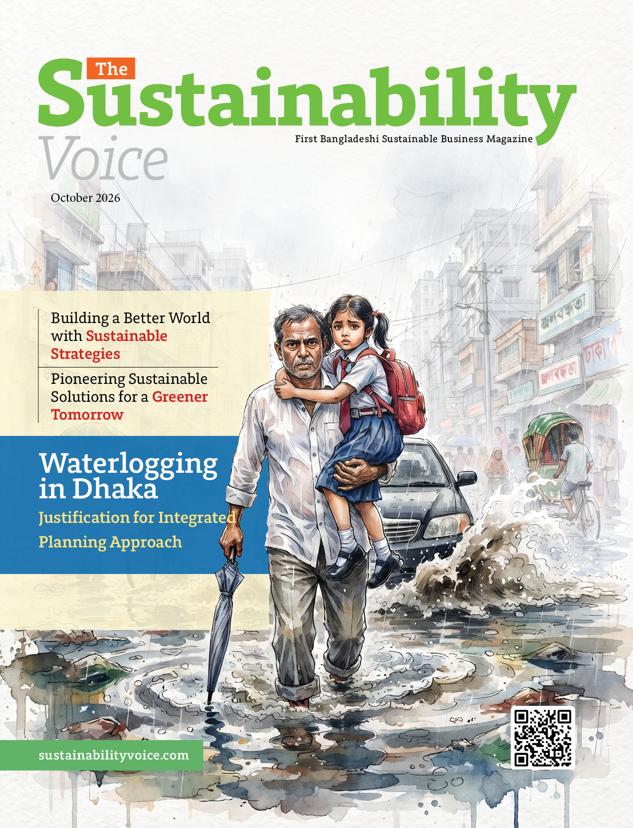

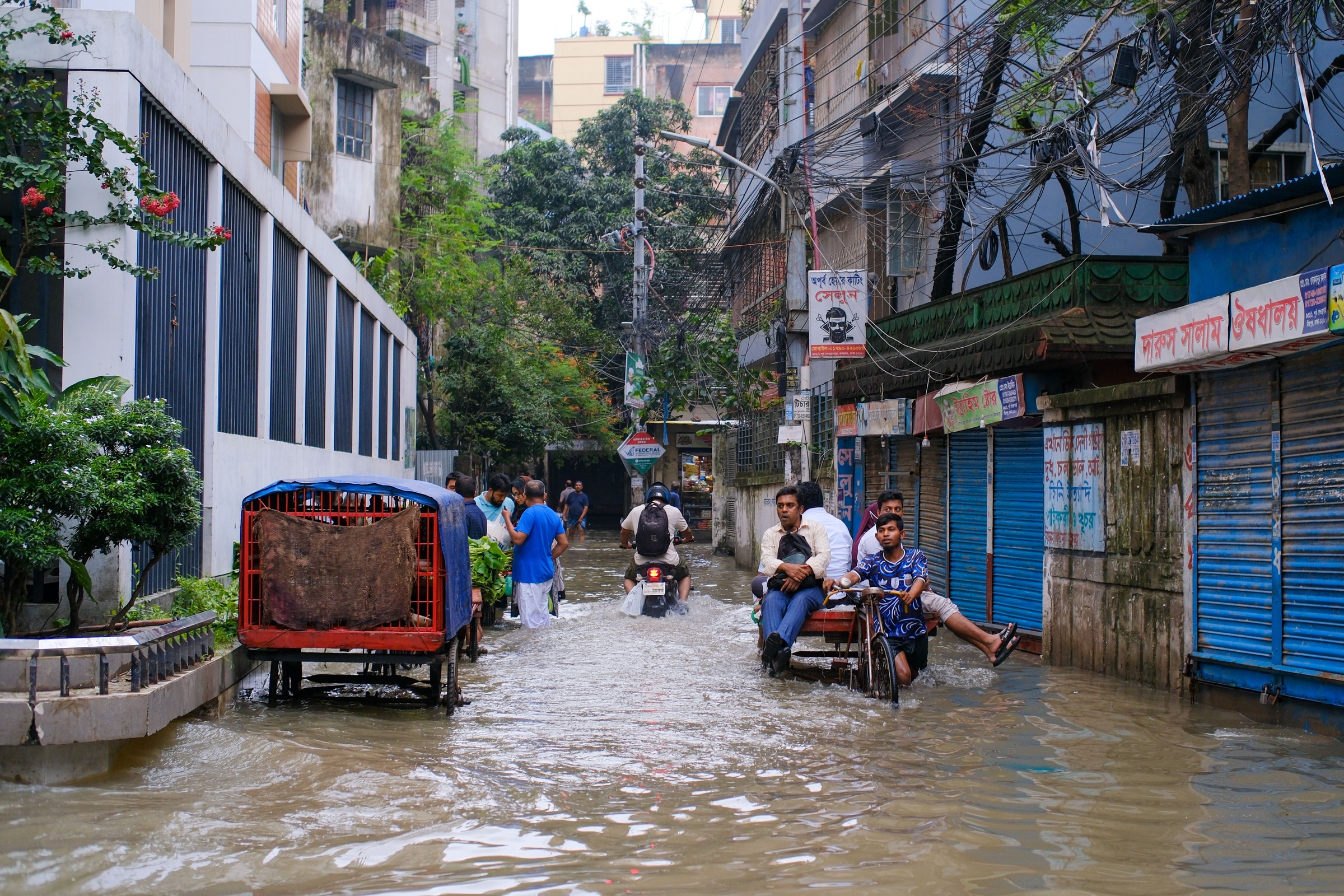
Waterlogging in Dhaka: A Growing Urban Challenge
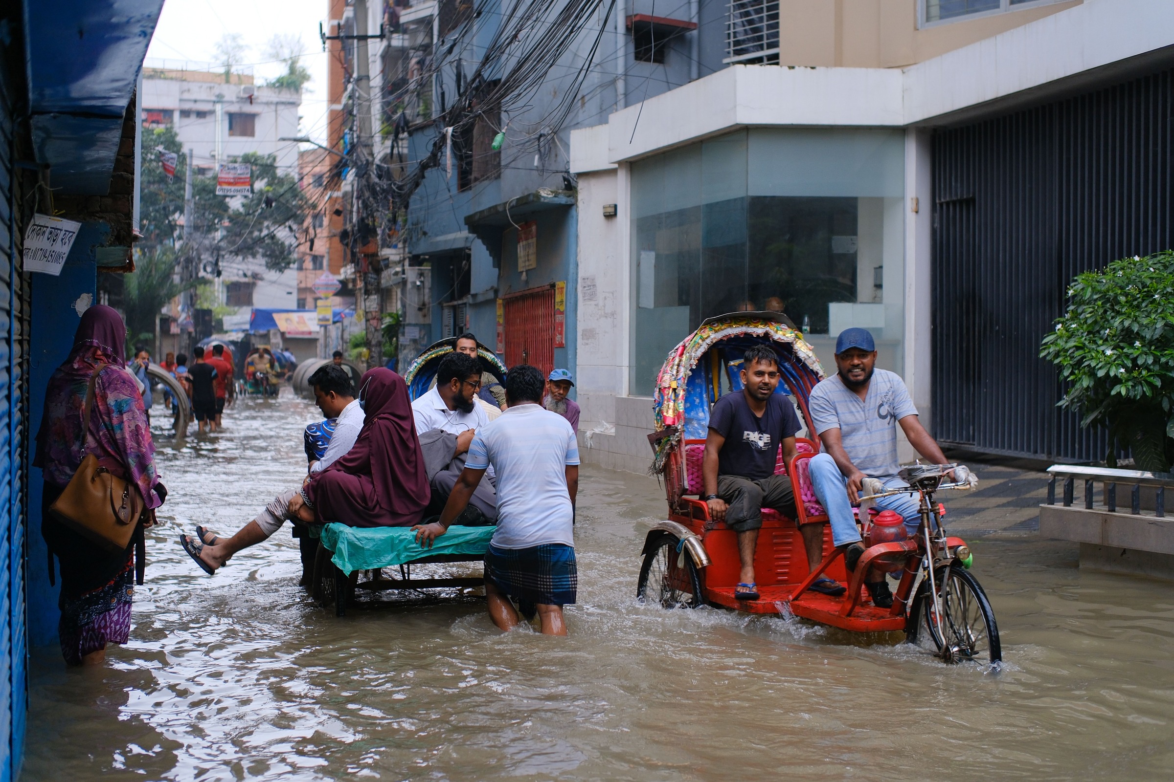
Waterlogging is a persistent urban challenge in Dhaka, where intense monsoon rainfall rapidly inundates roads, neighborhoods, and commercial areas. This disrupts mobility, creates severe traffic congestion, damages infrastructure, affects public health, and reduces city livability.
Recent events highlight the growing pressure on Dhaka’s drainage system. The Bangladesh Meteorological Department (BMD) recorded approximately 196 mm of rainfall within 24 hours on 29–30 May 2025—the capital's highest May rainfall in 54 years. In July 2026, Dhaka received 175 mm in 24 hours, the highest one-day total since 2009's 333 mm record.
These events show that Dhaka must prepare for high-intensity rainfall, which climate change may further exacerbate through altered precipitation patterns. However, rainfall is only the immediate trigger. The scale and persistence of waterlogging result from rapid urbanization, expanding impermeable surfaces, canal and wetland encroachment, loss of natural retention areas, blocked drainage pathways, inadequate downstream outlets, and fragmented system management.
Historically, Dhaka’s natural network of canals, wetlands, flood-flow zones, and rivers conveyed and stored stormwater. Rapid development has weakened this system while increasing runoff volume and speed. Consequently, more stormwater is generated within the city while natural retention and discharge pathways decline.
Waterlogging is not merely a shortage of drains or pumps; it is a citywide hydrological and urban-planning challenge. A sustainable response requires an integrated, catchment-based approach that restores hydraulic connectivity, protects natural retention systems, upgrades engineered drainage, and aligns stormwater management with land-use planning.
Why has Dhaka Become Increasingly Vulnerable?
Loss of Natural Drainage and Retention Capacity
Dhaka historically depended on an interconnected system of canals, wetlands, low-lying areas, flood-flow zones, and surrounding rivers, each performing crucial hydrological functions. Canals conveyed runoff, wetlands temporarily stored excess water, and natural corridors gradually moved stormwater from built-up areas toward receiving water bodies.
Rapid, inadequately controlled urbanization has disrupted this system. Canals and channels have been filled, narrowed, or encroached upon; wetlands and retention areas have been converted to urban uses; and infrastructure has been built across natural drainage pathways without maintaining hydraulic connections.
The scale of this loss is concerning. Dhaka has lost approximately 3,440 acres of flood zones and waterbodies since DAP-2010. Furthermore, a Bangladesh Institute of Planners (BIP) study identified the filling of roughly 3,483 acres of waterbodies and lowlands across the metropolitan area between 2011 and 2019.
This is a direct reduction in the city’s capacity to manage stormwater rather than just an environmental loss. Filled wetlands eliminate storage capacity, narrowed canals reduce conveyance capacity, and disconnected corridors force water to find alternative routes. Consequently, declining natural storage places greater pressure on the engineered drainage system.
Protecting Dhaka’s remaining canals, wetlands, flood-flow zones, and retention areas must therefore be treated as an essential component of the city’s drainage infrastructure and climate-resilience strategy, not merely an environmental goal.
Urbanization and Increasing Surface Runoff
Urbanization fundamentally alters post-rainfall hydrology. In natural or semi-natural settings, rainfall infiltrates the soil, settles in low-lying storage, or slowly flows into natural drainage channels.
Conversely, dense urban development—with widespread roofs, roads, and paved surfaces—drastically reduces soil infiltration. Consequently, a much higher proportion of rainfall becomes surface runoff, reaching the urban drainage network significantly faster.
Dhaka is experiencing two simultaneous pressures: rapid surface runoff is increasing while natural spaces and drainage pathways needed to retain and convey it are decreasing.
Earlier research by Mowla and Islam (2013) similarly cited rapid, uncontrolled urbanization, inadequate drainage infrastructure, and inefficient management as key contributors to rainfall-induced waterlogging. They emphasized the need for urban planning and design tailored to Dhaka’s geo-climatic and hydrological characteristics.
The core issue is not simply a shortage of drains. Rather, the broader problem is that the connection between urban development, natural hydrology, and engineered drainage infrastructure has progressively broken down.
Waterlogging as a Social Vulnerability Issue
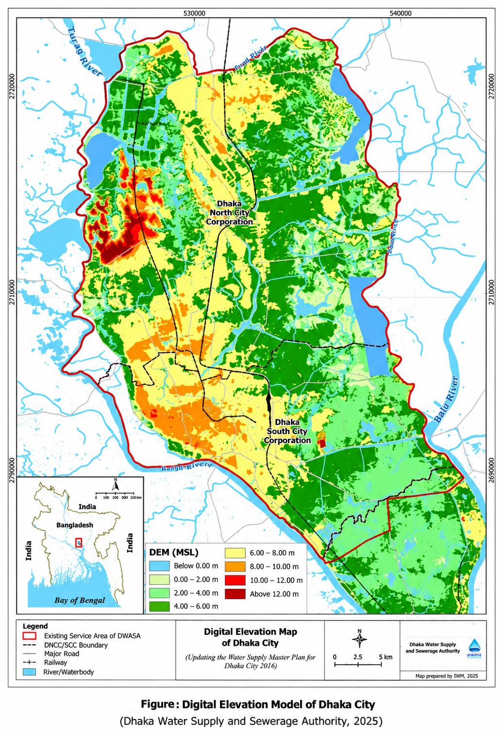
Waterlogging does not affect all areas or residents equally. Using GIS and remote-sensing analysis, Alam et al. (2023) revealed significant spatial variation in Dhaka’s waterlogging vulnerability: roughly 35% of the city falls into high- or very-high-vulnerability zones, particularly in southern and south-western areas, while northern urban expansion has also heightened exposure.
This challenge carries a critical social dimension. Many slum households live in poorly constructed housing within these high-risk zones.
Consequently, waterlogging is an issue of urban resilience and social vulnerability rather than just engineering. Lower-income populations have fewer resources to recover from property damage, employment disruptions, restricted mobility, and health impacts. Drainage investments must therefore consider both where water accumulates and who is most vulnerable to its impacts.
The Core Structural Problem: Loss of Hydraulic Connectivity
How an Urban Drainage System Works
One of the most important issues in understanding Dhaka’s waterlogging is hydraulic connectivity. A city drainage system does not function as a collection of independent drains. It functions as a connected network. In simplified form, stormwater generally needs to move through the following sequence:
Local/Tertiary Drain → Secondary Drain → Primary Drain or Canal → Outfall/Retention System → Receiving River or Water Body
For effective drainage, each component must have adequate capacity and remain hydraulically connected to the next.
A locality may have a clean and adequately sized roadside drain but still experience severe waterlogging if that drain cannot discharge into the secondary drainage network.
Similarly, a secondary drain may function properly but remain ineffective if the receiving canal has been filled, narrowed or obstructed. Even a restored canal will provide limited benefit if its downstream outfall is blocked or if its connection to the receiving river or water body has been lost.
Therefore:
A drainage system is only as effective as its weakest or disconnected downstream component.
Or, stated another way:
Drainage capacity without hydraulic connectivity cannot provide effective drainage.
3.2 The Waterlogging Location May Not Be the Problem Location
This distinction is particularly important for planning drainage interventions: the location where water accumulates is not necessarily where the drainage system has failed.
For instance, roads may flood due to a downstream culvert block hundreds of meters away, neighborhoods remain waterlogged because receiving canals are obstructed, or areas flood because historical outfalls no longer function.
Consequently, isolated interventions—such as cleaning a single drain, enlarging a culvert, or installing temporary pumps—may offer localized relief but fail to resolve the broader waterlogging challenge.
The key planning question should therefore not simply be:
“Where is the waterlogging?”
It should also ask:
“Where within the drainage system is the flow being interrupted?”
3.3 From Waterlogging Hotspots to Drainage Catchments
The two city corporations have identified approximately 141 waterlogging-prone locations—108 in Dhaka North (DNCC) and 33 in Dhaka South (DSCC). While identifying these hotspots helps prioritize emergency management, they should not be treated as 141 independent problems.
Instead, these hotspots represent visible manifestations of wider structural weaknesses in the metropolitan drainage network. Each major hotspot should be investigated across its full drainage catchment, examining both the upstream runoff generators and the downstream discharge channels. This catchment-wide approach shifts waterlogging management from treating visible local symptoms to addressing underlying systemic failures.
Current Responses and Lessons from Dhaka
While measures by DNCC and DSCC are necessary for immediate risk reduction and seasonal drainage performance, current experience highlights that standalone interventions must be integrated into the broader drainage network.
DSCC: Hotspot Management and Emergency Response
DSCC has identified 33 waterlogging hotspots and established ward-based emergency response teams combining engineering and waste-management personnel.
Temporary pumping units have expanded from two to eight, deployed at critical points like New Market, Dhanmondi, Hawkers Market, Bakshibazar, Chanmari Intersection, Rajarbagh, and Fakirapool. Regular staff and contractors are also actively clearing drains.
These measures deliver valuable short-term relief by clearing blockages and pumping out accumulated water. However, pumping remains an operational stopgap rather than a substitute for a functioning drainage network. Without adequate gravity-based drainage and downstream outlets, the city relies excessively on continuous mechanical intervention.
The New Market and Mirpur Road area illustrates this challenge. The closure of a BDR outlet reduced overall network capacity, exacerbating local flooding. Consequently, DSCC proposed a Tk 250–300 crore drainage project for Dhanmondi, New Market, and Bakshibazar to extend outlets toward the river and construct multiple discharge routes.
The example illustrates an important drainage principle:
Improving the drain at the waterlogged location may be insufficient if the downstream discharge pathway is missing, constrained or obstructed.
DNCC: Canal Restoration and Drainage Maintenance
DNCC faces a distinct yet equally complex challenge. The city corporation oversees approximately 29 canals, prioritizing key waterways for intervention, including the Sangbadik, Baunia, 22-Feet, Ramchandrapur, Tolarbag, and Kalyanpur Canals.
To clear accumulated sludge and solid waste, DNCC is undertaking canal cleaning, excavation, and restoration. It is also considering mechanized or robotic technology for hazardous cleaning tasks, particularly inside box culverts.
However, a canal can physically exist while losing its hydraulic function when sedimentation, solid waste, encroachment, or poorly designed crossings reduce its effective cross-section.
Canal restoration alone cannot guarantee effective drainage. A restored canal offers limited benefit if surrounding secondary and tertiary drains cannot discharge into it, or if its downstream connection to an outfall, retention area, or river remains constrained. Drainage management must therefore shift from maintaining individual assets to ensuring the performance of the complete, connected network.
Northern Dhaka: When the Drainage Network Loses Its Path
The rapid development in Ashkona, Dakshinkhan, and Uttarkhan illustrates how altered natural drainage pathways and lost wetlands transform localized drainage gaps into broader structural failures across Dhaka.
In these areas, the core problem extends beyond undersized roadside drains; it stems from lost natural storage, blocked historical corridors, and compromised downstream outfalls that prevent water from discharging safely into receiving water bodies.
The more fundamental question is:
Where is the water supposed to go?
Where natural channels have been interrupted, wetlands converted, canals encroached upon and downstream connections lost, constructing or cleaning another local drain may provide only limited or temporary relief.
Long-term improvement therefore requires catchment-level investigation involving:
catchment and sub-catchment delineation;
topographic and drainage surveys;
mapping of existing and historical drainage pathways;
hydrological and hydraulic modelling;
identification of drainage bottlenecks;
restoration of critical canals and drainage corridors;
identification and protection of viable outfalls; and
protection of remaining retention areas.
4.4 Key Lesson from Current Interventions
The experience of both city corporations highlights an important distinction.
Cleaning drains, restoring canals, improving culverts and installing pumps are necessary interventions, but their long-term effectiveness depends on whether the entire upstream-to-downstream drainage pathway remains hydraulically connected.
This means that individual drainage projects should increasingly be planned and evaluated according to their contribution to the performance of the overall catchment, rather than only their effect on a specific road or waterlogging hotspot.
Towards an Integrated and Catchment-Based Approach
Why the Catchment Should Be the Planning Unit
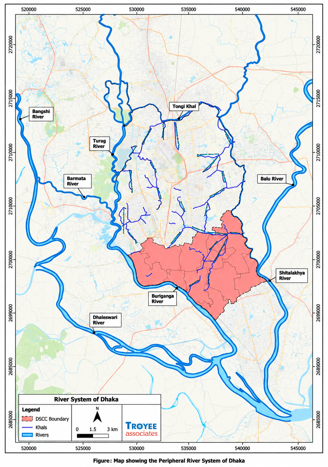
Water operates along topographical and hydraulic gradients rather than administrative boundaries, with drainage catchments often spanning multiple wards, jurisdictions, and institutions. Consequently, stormwater generated in one area frequently depends on infrastructure or natural channels located in another.
This reality highlights the core flaw of localized or jurisdiction-bound planning: constructing a drain offers little benefit if downstream channels are blocked elsewhere, and restoring a canal is ineffective if surrounding development continues to sever natural pathways or eliminate retention areas. Therefore, effective drainage planning must start at the catchment level rather than with individual roads, wards, or administrative boundaries.
For each major drainage catchment, planners and engineers should understand:
where stormwater is generated;
how much runoff is generated under different rainfall conditions;
where the water currently flows;
where it historically flowed;
which tertiary and secondary drains carry it;
which primary drains or canals receive it;
where temporary retention or detention can occur;
where the final outfalls are located;
whether those outfalls remain functional; and
what physical or institutional constraints interrupt the system.
Only after understanding the complete system can individual drainage investments be properly prioritized and designed.
From “Drain-and-Pump” to Integrated Stormwater Management
While engineered infrastructure—drains, culverts, canals, pumping stations, and embankments—will remain essential, Dhaka must transition from a reactive "drain, clean, and pump" approach toward an integrated stormwater management strategy centered on four complementary principles:
First, restore and maintain hydraulic connectivity: Tertiary drains, secondary drains, primary canals, retention systems, outfalls and rivers should function as one connected drainage network.
Second, protect the remaining natural drainage and retention system: Canals, wetlands, flood-flow zones, lowlands and strategically important retention areas should be protected from further encroachment and incompatible development.
Third, increase the capacity to retain and delay runoff: Not every drop of rainfall must immediately enter underground drains; retention ponds, detention areas, permeable surfaces, rain gardens, green infrastructure, and sustainable urban drainage systems can effectively slow and reduce peak runoff where space and site conditions permit.
Fourth, integrate drainage into urban-development decisions: Land-use plans, roads, housing developments, building regulations and major infrastructure projects should be assessed in relation to the drainage catchments within which they are located.
Together, these measures would shift drainage from being treated mainly as an engineering service provided after urbanization occurs toward becoming a fundamental consideration in determining how urbanization itself takes place.
Integrating Drainage with Land-Use and Development Planning
Urban development itself changes drainage conditions. When a wetland is filled, storage capacity is lost. When open land is paved, surface runoff increases. When a road crosses a drainage corridor without adequate provision for water movement, hydraulic connectivity may be interrupted.
Therefore, drainage should not be addressed only after land-development decisions have already been made.
Major development proposals should consider:
whether the site affects a natural drainage corridor;
how development will change surface runoff;
whether existing downstream drainage has adequate capacity;
whether canals, wetlands or retention areas will be affected;
whether additional retention or detention is required; and
whether existing hydraulic connections will remain functional.
Stormwater management must become an integral component of land-use planning, development control, road design, building regulations, and major infrastructure investments.
This integration is especially vital in rapidly urbanizing areas where natural drainage pathways remain but face mounting development pressure. Protecting an active drainage corridor before construction occurs is far more effective than attempting to reconstruct it after intensive urbanization has taken place.
Building Climate Resilience
The existing drainage system faces significant difficulty when rainfall exceeds approximately 80 mm, while heavier rainfall produces severe localized waterlogging. Recent extreme weather demonstrates that precipitation can far exceed these thresholds.
However, designing drainage infrastructure to eliminate flooding under every conceivable rainfall scenario is economically and physically impractical. A more realistic, resilient approach manages varying rainfall levels through a combination of:
conveyance + temporary storage + controlled overflow + emergency response.
A resilient drainage system should aim to manage regular rainfall with minimal disruption, reduce the depth and duration of waterlogging during severe storms, protect critical infrastructure and vulnerable communities, and recover rapidly after extreme events.
To achieve this, drainage standards must be periodically reassessed using updated rainfall records and projected climate scenarios rather than relying solely on historical patterns. Maintaining natural retention capacity is particularly vital under these conditions: during extreme events, wetlands, retention areas, and open drainage corridors offer crucial temporary water storage when engineered systems reach capacity.
Institutional Coordination and Shared Responsibility
Responsibility for urban development, roads, drains, canals, water management, land-use control, and surrounding water bodies is distributed among multiple institutions, including RAJUK, DNCC, DSCC, WASA, and LGED.
However, stormwater flows across infrastructure and natural systems managed by different entities. An interconnected drainage network cannot be managed through isolated institutional actions.
Road projects must consider drainage connectivity, land-development approvals must protect natural flow paths and retention areas, and canal restorations must account for both upstream connections and downstream outfalls.
Effective drainage management requires a shared common planning framework so agencies understand how individual decisions affect the broader metropolitan network. Institutional coordination must be embedded across planning, approval, implementation, and maintenance rather than treated as an occasional administrative task.
The Way Forward: An Integrated Drainage and Stormwater Management Master Plan
Purpose of the Master Plan
Dhaka requires a fundamental shift from fragmented, hotspot-based interventions toward an integrated, catchment-based Drainage and Stormwater Management Master Plan for the metropolitan area.
Rather than merely identifying locations for new drains, the plan's primary purpose should be to define the operational mechanics of the entire urban hydrological network—tracing stormwater from initial rainfall and runoff generation within individual catchments through to final discharge via canals, outfalls, and receiving water bodies.
Ultimately, this master plan would establish a unified technical framework to prioritize infrastructure investments, protect remaining natural drainage systems, coordinate multi-agency development, and guide resilient urban growth across the city.
Key Components of the Master Plan
The Master Plan should:
Delineate all major drainage catchments and sub-catchments;
Map the complete tertiary–secondary–primary drainage hierarchy;
Identify existing and historical natural drainage pathways;
Identify and assess major canals, wetlands, outfalls and receiving water bodies;
Identify missing, obstructed or inadequate hydraulic connections;
Undertake appropriate hydrological and hydraulic assessment of major drainage catchments;
Restore and protect critical canals and drainage corridors;
Identify and legally protect strategically important retention and detention areas;
Integrate drainage requirements into road, transport, infrastructure and land-development projects;
Establish appropriate hydraulic and stormwater-management requirements for new development;
Reassess drainage-design criteria using updated extreme-rainfall information and appropriate climate-change scenarios;
Identify opportunities for nature-based and decentralized stormwater-management measures;
Prioritize high-risk and socially vulnerable areas;
Establish clear institutional responsibilities for planning, construction, operation and maintenance;
Develop GIS-based drainage and asset-management systems;
Introduce appropriate monitoring, mechanized inspection and cleaning technologies; and
Establish a prioritized and phased investment program based on catchment-level needs and benefits.
Linking the Master Plan with Development Control
Crucially, the proposed Master Plan must not become another standalone infrastructure document; drainage planning must directly guide how Dhaka grows.
The identified catchments, drainage corridors, canals, retention areas, outfalls, and hydraulic requirements should be fully integrated into land-use planning, development control, transport planning, road design, and infrastructure investment decisions.
Without this connection, one agency may invest in drainage improvements while ongoing development elsewhere in the same catchment continues to eliminate retention capacity or block natural flow paths.
The ultimate goal is not only to repair the existing drainage network, but to prevent future urban development from creating new drainage problems.
Managing the System, Not Only the Waterlogged Location
Sustainably resolving Dhaka’s waterlogging cannot be achieved by treating every inundated road, intersection, or neighborhood as an isolated problem.
While cleaning drains, excavating canals, deploying pumps, and constructing infrastructure remain essential, their impact will stay limited if the wider hydraulic system loses connectivity, canals and wetlands disappear, retention areas are developed, downstream outfalls remain constrained, and urban expansion continues without accounting for natural drainage and catchment hydrology.
The fundamental planning question should therefore change from:
“Where do we need a bigger drain or another pump?”
to:
“Where will the stormwater come from, how much needs to be managed, where can it be safely retained, through which connected pathway will it flow, and where will it ultimately discharge?”
Future Look
Climate change may alter future rainfall intensity, but its local consequences will depend on how Dhaka manages its land, wetlands, canals, and infrastructure. While the city cannot control rainfall volume, it can directly influence runoff generation, water retention, drainage flow, and safe discharge.
The long-term goal must shift from simply adding infrastructure to building an integrated, climate-resilient system where natural water bodies, engineered assets, land-use planning, and institutional management operate as one. For a rapidly growing, climate-exposed megacity like Dhaka, transitioning to catchment-based stormwater management is essential for long-term viability, resilience, and livability.